
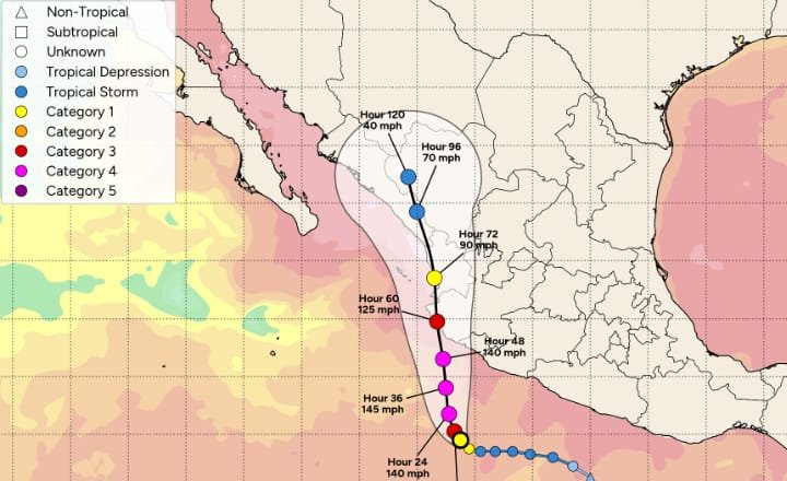
Hurricane Simon in the Pacific is rapidly intensifying and seen as having a chance of sustaining major hurricane strength when it makes landfall on the Mexico coastline on Sunday, which has brought the $175 million IBRD CAR Mexico 2024 (Pacific) parametric catastrophe bond back into focus again.
Update – Oct 10th, 09:00 UTC: Hurricane Simon is a little stronger at 145 mph sustained winds, while the minimum central pressure is now estimated at 942mb.
New forecast advisory data from the NHC shows hurricane Simon is still expected to become a very strong Category 4 or even a Category 5 hurricane later today. It seems from the data though, that less weakening is now anticipated prior to landfall, with the forecast advisory data suggesting Simon could reach landfall still at Category 4 wind speeds.
Our sources suggest that hurricane Simon could now get closer to the low-levels of central pressure required to trigger Mexico’s parametric catastrophe bond. But, how much the storm can intensify today matters, as well as any weakening that occurs before it crosses into one of the parametric boxes.
One projection we’ve seen calls for the central pressure of hurricane Simon to be in the 930mb’s when it crosses the cat bond’s parametric grid. As we said yesterday, we believe it may need to fall to 932mb or lower for a 25% payout to come due. At this stage we’re told it could just be a few millibars away.
Mexico’s $175 million parametric IBRD Pacific named storm catastrophe bond is on watch again with this storm. We’ll update you later today.
Update – Oct 10th, 07:00 UTC: Hurricane Simon has continued to intensify as forecast, with the latest NHC data showing a dangerous Category 4 storm with 140 mph winds, higher gusts and now a central pressure much lower at an estimated 945mb.
The NHC says that, “Additional rapid strengthening is expected during the next day or so. Simon is forecast to approach the of west-central Mexico as a major hurricane this evening or Sunday.”
However, Simon is relatively small which could hold back its intensification somewhat, currently hurricane force winds only extend outward around 15 miles from its centre. So it remains to be seen whether the central pressure can continue to deepen sufficiently to really threaten Mexico’s catastrophe bond.
In addition, the forecast advisory data from 03:00 UTC today shows hurricane Simon reaching sustained winds of around 155 mph near its peak, but then weakening slightly prior to landfall with wind speeds of around 135-140 mph prior to landfall. So it could near or reach Category 5 status for a time, but weaken back to Category 4 or less at landfall.
Remember though, the parametric zones for the Mexico Pacific named storm parametric cat bond are slightly offshore, not on the coastline, so it is the central pressure at the time any hurricane crosses one of the parametric zones that matters.
At this stage hurricane Simon will need watching through Saturday, to see how intense it can become and whether it is likely to pose a threat to Mexico’s IBRD cat bond on nearing landfall.
Update – 18:00 UTC: The NHC’s latest update and forecast advisory data shows hurricane Simon now with sustained winds of 100 mph and higher gusts. The all-important (for the cat bond) central pressure is now down to 973mb.
The NHC said Simon should intensify rapidly now and approach Mexico’s coast as a dangerous major hurricane, strengthening through into Saturday.
There are suggestions in the forecast data that hurricane Simon could have sustained winds of around 130 mph very close to making landfall. How long the intensification continues will have ramifications for how much the storm weakens. Although it’s important to remember that for Mexico’s cat bond to face a trigger event, it would need the minimum central pressure to deepen considerably, by perhaps 40mb or more.
Only a couple of weeks ago in September this parametric catastrophe bond faced a threat from hurricane Polo, a storm that intensified rapidly and whose minimum central pressure deepened to levels required to activate the cat bond’s parametric trigger, but Polo weakened and in the end made landfall posing no threat of a loss.
While many in the market are closely watching the Atlantic side with hurricane Isaias strengthening in the Gulf of Mexico, hurricane Simon in the Pacific is just the latest storm on that side to undergo rapid intensification and could even have the potential to pose the bigger cat bond market threat, albeit with only a single tranche of notes from the Mexico IBRD deal exposed to the storm.
Hurricane Simon is currently a category 1 storm with sustained winds of 90 mph and a minimum central pressure of 978mb, as of the NHC’s 12:00 UTC update today.
However, that update explains that Simon is rapidly intensifying and expected to become a major hurricane today.
The NHC said, “Rapid intensification is expected to continue, and Simon is expected to be a very dangerous major hurricane when it approaches the coast of Mexico.
“Simon’s small, intense inner core, favorable environmental conditions, low shear, very warm oceanic temperatures, and high mid-level moisture content all support a rapid intensification event, which appears to be well underway. Further significant strengthening is expected, and the cyclone is forecast to be a very dangerous major hurricane when it approaches the coast of Mexico. The guidance also shows compact Simon quickly weakening and over the high mountainous terrain by early next week. The NHC forecast is once again hedged toward the high end of the guidance, in best agreement with the HFIP-HCCA model.”
The NHC’s forecast advisory data as of the same time shows hurricane Simon attaining sustained wind speeds of up to 145 mph as it approaches the Mexico coastline, albeit with some weakening expected as it closes in on landfall, which is expected to be in the southwestern and west-central region of Mexico on Sunday.
The forecast cone shows hurricane Simon making landfall as a Category 3 major storm, but with rapid intensification underway it remains to be seen how strong this storm can become, given the very conducive conditions it is passing through of very warm waters and low shear.
Currently, many forecast models do not seem to have re-calibrated to take account of the rapid intensification currently underway with hurricane Simon. Once they do, we should have a clearer picture of how low the central pressure could drop as it moves towards Mexico and landfall.
You can see hurricane Simon’s current position and the forecast in the graphic below from Tomer Burg’s PolarWx:
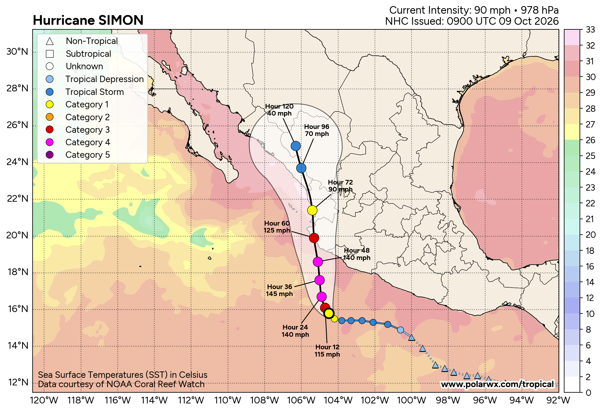
At a minimum central pressure of 978mb at this time, hurricane Simon is still well-above the levels required to trigger Mexico’s parametric IBRD Pacific named storm catastrophe bond.
But the forecast takes it directly ashore at landfall, so it will likely pass through the parametric trigger zones that run along Mexico’s coastline, just offshore.
The $175 million of IBRD CAR Mexico 2024 (Pacific) parametric catastrophe bond notes feature a parametric trigger design that requires a storm to have a minimum central pressure at or below specific levels in order to trigger a payout if it moves across the parametric grid lines.
Different areas of coastline have different payout factors attached to them as well, so location and intensity are the two key metrics for defining whether any payout will occur and those payouts can be from 25% of principal, right up to the full 100% or $175 million, depending on where any hurricane breaches the parametric box and how intense it is (how low the pressure falls).
For the cat bond to be triggered at all, the initial central pressure threshold is at 937mb or lower for the parametric zones, albeit that the exact location matters for what kind of payout that could result in.
Sources we’ve spoken with suggest, based on the forecast landfall region for hurricane Simon, a central pressure of 932mb or lower may be required to trigger a 25% payout for the cat bond, while a much lower pressure would be required for any payout to be at 50% to 100% of the cat bond principal. Sources also suggest that, based on the current NHC data, Simon may deepen to 940mb prior to landfall, although that obviously comes with uncertainty and pressures can be lower than expected, while how much rapid intensification is actually seen will clearly be a factor over the coming hours.
It remains uncertain at this time whether hurricane Simon will intensify sufficiently to see its minimum central pressure decline to the levels required to trigger Mexico’s parametric cat bond. It seems that in order for a triggering event to occur, hurricane Simon would need to intensify further than the latest NHC forecast data suggests, this will require watching for.
But, given the NHC forecast and the rapid intensification deemed underway, it clearly has the potential to pose a threat, meaning catastrophe bond market participants are likely now watching both Pacific (Simon) and Atlantic sides (Isaias).
